Camelback Mountain Hiking Guide: Trails, Permits And Difficulty
Camelback Mountain is the most recognizable hike in the Phoenix metro, and also one of the most punishing. This guide covers the two summit trails, the heat-season timing that matters more than any gear list, and the guided desert alternatives for days when the trail is the wrong choice.
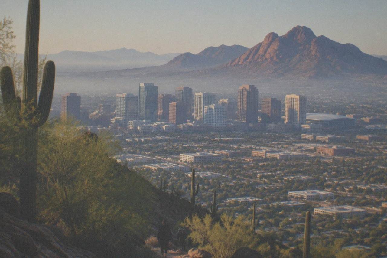
Short answer
Camelback Mountain has two summit routes, Echo Canyon and Cholla, both rated extremely difficult scrambles with hand-over-hand sections near the top. No permit or reservation is needed. Hike at or before sunrise from October to April, and in summer treat the mountain as a dawn-only objective, or swap it for a guided sunset jeep tour from $155 per person.
Camelback Mountain sits inside the Phoenix city limits, a red sandstone hump between the Arcadia neighborhood and Scottsdale, and it is the hike locals point visitors toward first. That recommendation comes with a catch: the mountain is short by Colorado standards but brutally steep by desert standards, and every summer Phoenix-area rescue crews carry injured or overheated hikers off its flanks. The two summit trails are more scramble than walk, the sun offers almost no mercy after mid-morning, and the trailhead lots fill before dawn in peak season.
This guide lays out what the mountain actually demands: how the two routes differ, when the heat makes the climb a bad idea, what belongs in your pack, and how a guided desert tour covers similar scenery for travelers who would rather not earn it on foot. For a wider look at the region's options, the Day Tours from Phoenix homepage sorts every bookable departure by destination and price.
Why Is Camelback Mountain Hiking Considered So Hard?
Camelback gains its elevation over a brutally short trail, slickrock, loose gravel, and sections where you use your hands. It is rated extremely difficult by the City of Phoenix, and that rating is earned: the upper half of both routes is a scramble, not a staircase. No permit, reservation or entrance fee is required, which removes every barrier except the one that matters, the climb itself.
The difficulty surprises people because the summit elevation is modest by mountain standards; the gradient is what punishes. Both main trails gain their elevation over short distances, and the final stretches involve polished rock faces with railings and handholds that hikers queue behind on busy mornings. Coming down is its own project: loose surfaces, tired legs, and the same exposed rock in reverse.
Heat is the second reason the mountain has a reputation. Phoenix summers regularly push past the point where the National Weather Service issues heat alerts, and the agency does not use a single fixed temperature trigger: its HeatRisk framework weighs the forecast high, the overnight low, how long the heat lasts, and how unusual it is for the date. Practically, that means checking the live NWS Phoenix forecast rather than a number you remember from a past trip. On a Major or Extreme HeatRisk day, mid-morning on exposed sandstone is a rescue waiting to happen.
The third factor is crowding. The trailhead lots are small relative to demand, and on peak winter weekends the summit trail can feel like a line rather than a wilderness path. None of this makes Camelback a bad hike. It makes it a hike that punishes improvisation, which is exactly why this page exists.
Echo Canyon Or Cholla: Which Camelback Trail Should You Take?
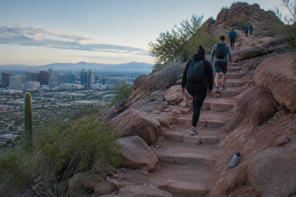
Echo Canyon is the classic route: shorter, steeper, and a true boulder scramble with railings near the top, on the mountain's west side off Tatum Boulevard. Cholla is slightly longer and steadier, approaching from the east via Invergordon Road, with flat trail before its own rocky climb. Both reach the same summit in roughly the same time, and neither is beginner terrain. Echo Canyon suits hikers who want the direct line; Cholla spreads the effort out.
The honest comparison is less about scenery, which is nearly identical from the top, and more about what kind of suffering you prefer. Echo Canyon front-loads nothing: the climb starts within minutes of the trailhead and does not relent. Cholla gives you a warm-up, then takes payment with a steep, exposed final mile that many hikers consider harder than Echo's famous staircase because it lasts longer.
| Feature | Echo Canyon Trail | Cholla Trail |
|---|---|---|
| Start point | Echo Canyon lot, west side | Cholla lot, east side off Invergordon Road |
| Distance and climbing | Shorter round trip, steep grade throughout | Slightly longer round trip, same punishing gain |
| Character | Steep scramble, railings and handholds near the summit | Flatter start, long steep finish on rock |
| Crowds | Heaviest, the classic route | Heavy but slightly thinner |
| Best for | Hikers who want the shortest hard line | Hikers who want a warm-up before the grade |
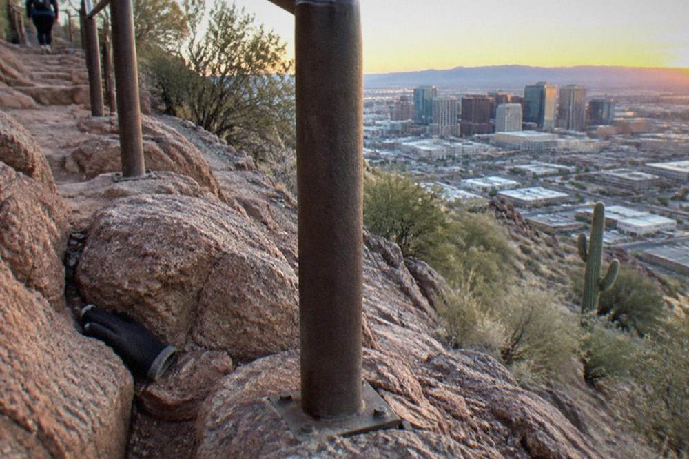
Cholla's history matters to planning. The trail has been closed for extended periods in past years for repairs and stabilization, and hikers have repeatedly shown up to find it shut. The City of Phoenix parks pages carry the current status for both trailheads, and checking them the night before is a two-minute habit that saves a wasted drive. If Cholla is closed, Echo Canyon absorbs the demand, which means arriving even earlier.
Neither route has water, shade or facilities beyond the trailhead. Whatever you carry is what you have. That single fact drives more bad days on this mountain than any other, and it is why the packing section below is longer than you might expect for a hike this short.
If reading about a hand-over-hand scramble in desert heat has already trimmed your interest, the guided alternatives later in this page cover the same terrain from a seat. The trio below is where most readers land: a sunset jeep tour, a sunrise balloon flight, and a full-day Grand Canyon and Sedona departure for the bucket-list day.
When Is The Best Time Of Year To Hike Camelback Mountain?
October through April is the real hiking season, with November to March offering the most comfortable conditions. In those months a 7 a.m. start is pleasant; by late spring, 7 a.m. is already late. From June through September the mountain is a sunrise-only objective: on the trail by first light, off before 10 a.m., or not at all. Afternoon hiking in summer is not toughness, it is the scenario rescue teams train for.
The seasonal logic is simple. Winter highs in Phoenix sit in the range where exposed sandstone is comfortable, and the low angle of the sun keeps the rock from storing the furnace heat it holds in July. Spring and fall are transitional: gorgeous at dawn, punishing by 10 a.m. Summer is a different sport entirely, and the NWS HeatRisk system described earlier is the right tool for judging any specific date, because it accounts for overnight lows, which is what actually determines whether your body recovers between days.
Monsoon season, roughly July through September, adds a second hazard: flash flooding and lightning. A storm over the mountain can turn the slickrock into a slide in minutes, and exposed summits are exactly where you do not want to be when thunder echoes off the walls. If the forecast shows afternoon storms, the window is dawn, full stop. For road and route conditions elsewhere in the state on storm days, Arizona's 511 traveler information service posts live closure data.
Timing also decides your parking fate. Both lots fill before sunrise in peak season, and the overflow situation on the surrounding residential streets is enforced. Locals treat a Camelback start as a 5:30 a.m. commitment in March, not because they love the dark, but because the alternative is circling a full lot at 6:15.
For travelers whose Phoenix visit falls in the hot half of the year, the swap is straightforward: do the mountain in winter, and in summer let someone else drive the desert. A guided sunset jeep tour runs in the part of the day when the heat finally breaks, and a sunrise balloon flight floats above the same terrain while the ground is still cool. Both are covered in detail two sections down.
What Should You Bring For A Camelback Hike?
Water is the non-negotiable item: a minimum of one liter per person in winter, two liters from April through October, and more on a HeatRisk-flagged day. Beyond that: real hiking shoes with grip, sun protection, salty snacks, a headlamp if you start at dawn, and a phone. The mountain has no water, no shade and no bail-out once you are past the first benches, so the pack list is a safety document, not a comfort list.
Footwear deserves a specific word. The upper sections of both trails are polished sandstone that turns treacherous on the descent, and the combination of running shoes and tired legs is a recurring ingredient in the rescues. Trail runners with sticky soles work; smooth-soled sneakers and sandals do not. Trekking poles help on the way down more than the way up, and many hikers who skip them going up regret it coming down.
| Item | Winter hike (Oct-Apr) | Summer hike (Jun-Sep) |
|---|---|---|
| Water | 1 liter minimum per person | 2 liters minimum, more on heat-alert days |
| Start time | Sunrise to mid-morning | On trail by first light, off by 10 a.m. |
| Layers | Light jacket for the start | None, but sun coverage matters more |
| Sun protection | Hat, sunscreen, sunglasses | Same, plus a long-sleeve sun shirt |
| Snacks | Salty snacks | Salty snacks, eaten on a schedule |
| Phone | For photos and emergencies | Same, plus checking the NWS forecast |
The salt point is not a throwaway. Heavy sweating in dry heat depletes sodium faster than most people notice, because sweat evaporates instantly and never soaks a shirt. Hikers who drink large volumes of plain water on a hot climb without replacing salt can end up in worse shape than dehydrated ones. Pretzels, electrolyte tabs or salty crackers are standard kit for desert guides in this region, and there is no reason a solo hiker should treat it differently.
One more rule that locals follow and visitors learn the hard way: turn around at the first sign of dizziness, nausea or headache. The summit is a viewpoint, not a trophy, and the mountain will still be there tomorrow. Every rescue narrative from this mountain includes a hiker who pushed through early symptoms because the top looked close. It is closer than it looks from the bottom and farther than it looks from the halfway point.
Is A Guided Desert Tour A Better Option Than Hiking Camelback?
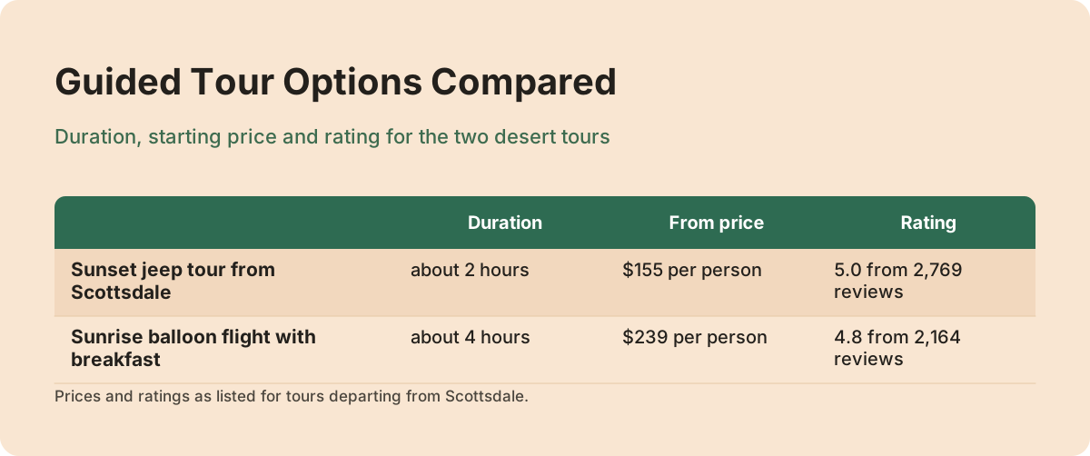
For many visitors, yes. A guided jeep or balloon tour delivers the same Sonoran Desert scenery, red rock and sunset light, without asking you to be your own route-finder, water planner and heat manager. The sunset jeep tour from Scottsdale runs about 2 hours from $155 per person with a 5.0 rating from 2,769 reviews; the sunrise balloon flight with breakfast runs about 4 hours from $239 per person. Neither involves scrambling.
The comparison is not about toughness, it is about what the day is for. Camelback is a workout with a view attached. A guided tour is a view with a narration attached: which cactus is which, how the Sonoran ecosystem works, why the granite and sandstone sit next to each other the way they do. The jeep tours around Phoenix and Scottsdale mostly operate in Tonto National Forest under USFS special-recreation permits, which is why they can reach back-country terrain that a rental car, and certainly a pair of hiking shoes, cannot.
The sunset timing is the quiet advantage. Hikers get dawn or nothing in summer; jeep tours run in the golden hour, when the temperature drops, the saguaros throw long shadows and the desert does its best impression of friendly. The Sonoran Desert Jeep Tour at Sunset departs from Scottsdale, lasts about 2 hours, and costs from $155 per person, with a 5.0 rating across 2,769 reviews. It meets on site rather than offering hotel pickup, so plan the short drive. Check availability if the timing suits your trip, and see the site's full desert jeep tour guide for how the different vehicles and routes compare.
Balloons take the same logic vertical. The Phoenix Morning Hot Air Balloon Ride with Bubbly + Breakfast runs about 4 hours door to door and costs from $239 per person, with a 4.8 rating from 2,164 reviews. Hotel pickup is offered, and the listing is flagged as one that often sells out, which is consistent with ballooning generally: flights launch at dawn, baskets are small, and the good-weather windows in peak season are limited. The site's hot air balloon ride guide breaks down the four Phoenix-area flight options side by side.
How Does Camelback Fit Into A Wider Phoenix Itinerary?
Camelback works best as a half-day anchor: on the trail at dawn, done and eating breakfast by 9 a.m., with the whole afternoon free. Pair it with a low-effort afternoon, a pool, or a guided tour, because the climb takes more out of you than the mileage suggests. Travelers who try to stack Camelback and a second big activity on the same day usually sacrifice one of them.
The classic pairing is a hike plus a drive. Sedona sits about 115 miles north of Phoenix, roughly a two-hour drive, and a dawn Camelback summit followed by a Sedona afternoon is a genuinely great Arizona day, though it is a long one. The site's Sedona day trip guide covers that route in detail. The ambitious version is the Grand Canyon: about 225 miles, 3.5 to 4 hours each way, which is why most visitors let a tour operator do that driving. The Grand Canyon with Sedona and Oak Creek day tour runs about 11 hours from $229 per person, rated 4.8 from 566 reviews, with hotel pickup offered and a reputation for selling out. Shorter drives work too: Montezuma Castle National Monument sits about 95 miles north of Phoenix, roughly an hour and a half away, and Tucson and Saguaro National Park sit about 115 miles and two hours to the south.
| Day plan | Effort | Time needed | Best season |
|---|---|---|---|
| Camelback at dawn, pool afternoon | High, then zero | Half day | Oct-Apr |
| Camelback at dawn, sunset jeep tour | High, then seated | Full day | Oct-Apr |
| Sunrise balloon, afternoon in Scottsdale | None | Half day | Year-round, weather permitting |
| Grand Canyon and Sedona day tour | None, long day | About 11 hours | Oct-Apr preferred |
Season shapes the itinerary more than distance does. The site's best time of year guide ranks the months, but the short version: winter is for everything, summer is for dawn activities and air-conditioned drives, and the monsoon weeks add a daily check of the storm forecast to any plan that involves exposed terrain.
What Do You Need To Know About Parking And Trailhead Access?
Both trailheads are small city lots that fill before sunrise in peak season, and there is no reservation system for either. Echo Canyon's lot sits off Tatum Boulevard on the west side; Cholla's access runs through a residential neighborhood off Invergordon Road on the east, where street parking rules are enforced. Arrive by 5:30 a.m. from November to March, or expect to wait or leave. Restrooms exist at the lots; water does not exist on the trail.
The neighborhood point matters more than most guides admit. The Cholla approach funnels hikers through residential streets that were not built for trail traffic, and the city manages that friction with signage and enforcement rather than sympathy. If a parking app shows the lot full, the correct move is to come back the next morning earlier, not to improvise a spot. Echo Canyon has the same dynamic with less residential exposure but far more demand.
Rideshare is the quiet hack. A dawn drop-off at either trailhead removes the parking problem entirely, and the short fare from most Phoenix and Scottsdale hotels is a fair trade for an hour of sleep you would otherwise spend circling. The ride home is the catch: cell coverage on the mountain is fine, but at 9 a.m. you are competing with every other finished hiker for the same cars. Wait at the lot, not on the trail.
One logistics note for the guided-tour route instead: the jeep and balloon products above meet at defined departure points, several with hotel pickup offered, so they sidestep this entire section. That is not a small thing at 5 a.m. in a strange city.
Camelback rewards preparation and punishes optimism in equal measure. Pick the trail that matches your legs, start in the dark, carry more water than feels reasonable, and treat a heat-alert day as a signal to book a seat instead of lacing up. The same desert that makes the climb hard makes the guided alternatives spectacular.
Common Questions About Camelback Mountain Hiking
Is Camelback Mountain harder than it looks?
Yes, and by a wide margin. Both summit trails gain their elevation fast over slickrock and loose gravel, with hand-over-hand sections near the top. The mountain's modest summit elevation misleads people into treating it as a casual city hike, and the steady stream of rescues each summer is the evidence that it is not.
Do you need a permit or reservation to hike Camelback?
No. There is no permit, reservation or entrance fee for either trailhead. The only scarce resource is parking, which fills before sunrise in peak season. That is a first-come situation, not a bookable one, so the effective reservation system is your alarm clock.
Can beginners hike Camelback Mountain?
Beginners with real fitness and proper shoes, in cool weather, at dawn, can complete it. Beginners in sneakers at 10 a.m. in June should not attempt it. The trail is rated extremely difficult for a reason, and the upper sections require hands. If the description sounds like a hard gym session with a view, that is an accurate read.
How early should I arrive to park at Camelback?
By 5:30 a.m. from November through March, and earlier on weekends. Both lots overflow quickly, and the surrounding streets, especially near the Cholla trailhead, are residential with enforced parking rules. In summer the dawn start is required for heat anyway, so the parking and safety clocks point the same direction.
What is the best Camelback alternative if it is too hot to hike?
A guided sunset jeep tour from Scottsdale, from $155 per person for about 2 hours, covers the same Sonoran Desert scenery in the cool part of the day. A sunrise balloon flight from $239 per person takes you over the terrain instead of across it. Both remove the heat-management burden that makes summer hiking dangerous.